The Best Tools for Effective Land Management
- MK Dalton
- 6 days ago
- 4 min read
Land management is a critical aspect of sustainable development, agriculture, and environmental conservation. With the increasing pressures of urbanization, climate change, and population growth, effective land management tools have become essential for ensuring that land resources are used wisely and sustainably. This blog post explores some of the best tools available for effective land management, providing insights into their features, benefits, and practical applications.
Understanding Land Management
Land management encompasses a range of practices aimed at managing land resources for various purposes, including agriculture, forestry, urban development, and conservation. Effective land management involves:
Planning: Developing strategies for land use that balance economic, social, and environmental needs.
Monitoring: Keeping track of land use changes, soil health, and ecosystem conditions.
Regulation: Implementing policies and regulations to protect land resources and promote sustainable practices.
By utilizing the right tools, land managers can enhance their decision-making processes, improve resource allocation, and promote sustainable land use practices.
Geographic Information Systems (GIS)
What is GIS?
Geographic Information Systems (GIS) are powerful tools that allow users to visualize, analyze, and interpret spatial data. GIS integrates various data sources, including maps, satellite imagery, and demographic information, to provide a comprehensive view of land resources.
Benefits of GIS in Land Management
Spatial Analysis: GIS enables land managers to analyze spatial relationships and patterns, helping them make informed decisions about land use.
Data Visualization: Users can create detailed maps that illustrate land use changes, zoning regulations, and environmental impacts.
Resource Management: GIS can help identify areas suitable for agriculture, conservation, or urban development, optimizing land use.
Practical Applications of GIS
Urban Planning: Cities use GIS to plan infrastructure, manage zoning, and assess environmental impacts.
Agriculture: Farmers utilize GIS to analyze soil health, crop yields, and irrigation needs, leading to more efficient farming practices.
Remote Sensing
What is Remote Sensing?
Remote sensing involves the use of satellite or aerial imagery to collect data about the Earth's surface. This technology allows for the monitoring of land use changes, vegetation health, and environmental conditions without direct contact.
Benefits of Remote Sensing in Land Management
Comprehensive Coverage: Remote sensing provides data over large areas, making it ideal for monitoring extensive landscapes.
Timely Information: Users can access up-to-date information on land conditions, enabling quick responses to changes.
Cost-Effective: Remote sensing reduces the need for extensive field surveys, saving time and resources.
Practical Applications of Remote Sensing
Environmental Monitoring: Organizations use remote sensing to track deforestation, land degradation, and habitat loss.
Disaster Management: Remote sensing helps assess damage from natural disasters, guiding recovery efforts.
Land Use Planning Software
What is Land Use Planning Software?
Land use planning software assists in the development of land use plans by providing tools for analysis, visualization, and scenario modeling. These tools help stakeholders evaluate different land use options and their potential impacts.
Benefits of Land Use Planning Software
Scenario Modeling: Users can simulate various land use scenarios to assess their impacts on the environment and community.
Stakeholder Engagement: These tools facilitate collaboration among stakeholders, ensuring that diverse perspectives are considered in land use decisions.
Regulatory Compliance: Land use planning software helps ensure that proposed developments comply with local regulations and zoning laws.
Practical Applications of Land Use Planning Software
Community Development: Local governments use planning software to develop comprehensive plans that guide growth and development.
Environmental Impact Assessments: Developers utilize these tools to evaluate the potential environmental impacts of proposed projects.
Soil Management Tools
What are Soil Management Tools?
Soil management tools encompass a range of technologies and practices designed to monitor and improve soil health. These tools help land managers assess soil quality, fertility, and erosion risks.
Benefits of Soil Management Tools
Enhanced Crop Yields: By monitoring soil health, farmers can implement practices that improve fertility and increase crop production.
Erosion Control: Soil management tools help identify areas at risk of erosion, allowing for targeted interventions.
Sustainability: These tools promote sustainable land use practices by encouraging responsible soil management.
Practical Applications of Soil Management Tools
Precision Agriculture: Farmers use soil sensors and testing kits to optimize fertilizer application and irrigation, leading to more efficient farming.
Conservation Practices: Land managers implement soil conservation practices based on data from soil management tools to protect against degradation.
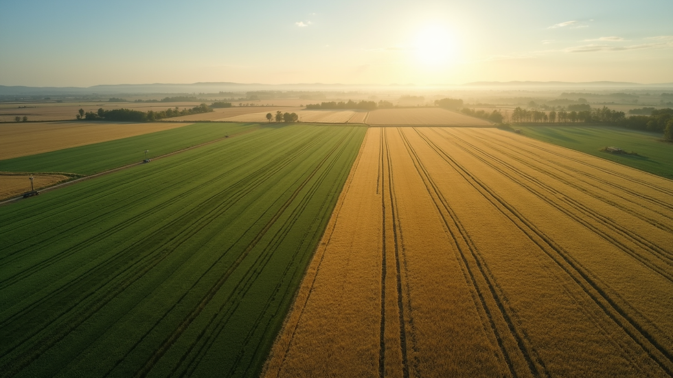
Drones in Land Management
What are Drones?
Drones, or unmanned aerial vehicles (UAVs), are increasingly used in land management for data collection and monitoring. Equipped with cameras and sensors, drones can capture high-resolution images and gather data over large areas.
Benefits of Drones in Land Management
High-Resolution Imagery: Drones provide detailed images that can reveal land use changes and environmental conditions.
Cost-Effective Monitoring: Drones reduce the costs associated with traditional surveying methods, making monitoring more accessible.
Rapid Data Collection: Drones can quickly cover large areas, providing timely information for decision-making.
Practical Applications of Drones
Agricultural Monitoring: Farmers use drones to assess crop health, monitor irrigation, and detect pests or diseases.
Environmental Surveys: Conservationists utilize drones to monitor wildlife habitats and assess the impacts of human activities on ecosystems.
Conclusion
Effective land management is essential for sustainable development and environmental conservation. By leveraging tools such as GIS, remote sensing, land use planning software, soil management tools, and drones, land managers can make informed decisions that promote responsible land use. These tools not only enhance efficiency but also support the long-term health of our land resources.
As you consider your approach to land management, think about how these tools can fit into your strategy. Whether you are a farmer, urban planner, or conservationist, embracing technology can lead to better outcomes for both people and the planet. Start exploring these tools today and take the first step towards more effective land management.


Comments